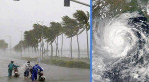
Cyclone Midhili is getting stronger; Bengal and Odisha could see a lot of rain. The India Meteorological Department (IMD) reported that on Friday morning, the deep depression over the Bay of Bengal strengthened into a cyclonic storm named “Midhili”.
With a maximum wind speed of 80 kmph, the cyclonic storm is expected to pass over the Sunderbans and make landfall on the coast of Bangladesh either on Friday night or early Saturday morning.
Over the northwest Bay of Bengal, a deep depression strengthened into a cyclonic storm known as “Midhili” (pronounced “Midhili”).
The IMD stated in its advisory that it was centered at 05:30 IST on November 17 over the Northwest BoB, roughly 190 km east of Paradip (Odisha), 200 km south-southeast of Digha (West Bengal), and 220 km southwest of Khepupara (Bangladesh).
It went on, “During November 17 night or early hours of November 18, the cyclonic storm is likely to continue moving north-northeastwards and cross Bangladesh coast close to Khepupara with wind speeds of 60–70 kmph gusting to 80 kmph.”
The weather service predicts that the cyclonic storm would cause severe rains over the next 24 hours in West Bengal’s coastal districts, including North and South 24 Parganas, Howrah, East Medinpur, and Kolkata.
Although the cyclone won’t have a significant effect on Odisha, it is expected to cause significant rainfall in certain areas of the state, including Kendrapara and Jagatsinghpur. According to news agency PTI, Odisha’s special relief commissioner has issued an alert to all district collectors in light of this.
Interestingly, the Maldives gave the name “Midhili.” Names of cyclones in sequence are provided by countries that are periodically affected by cyclones in the Arabian Sea and the Bay of Bengal.
The United Nations Economic and Social Commission (ESCAP) member nations as well as the World Meteorological Organization (WMO) adopted this approach.


